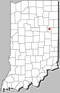
Montpelier Indiana | Some states have a "gis atlas". Here is the one for Indiana, however, I have never found a way to print these or save a photo. You have to do a lot of clicking on the right side to get the layer you want.
NOTE: IF YOU HAVE DAIL-UP, THIS WILL BE DARN SLOW. http://129.79.145.7/arcims/statewide%5Fmxd/viewer.htm You might also check with you courthouse, some counties have their own gis maps flown.
Update: Well you can print these, I just did one, you can also save one as a "bookmark". I pulled up one of our home farm, 2005 photos, it was shot in the winter. I can see the ruts I cut feeding round bales and my cows around the hay feeder. Also see my junk, looks like some one needs to clean up some around there! Just West of Montpelier on state road 18 on north side of road, green & white barns.
Edited by Ranger Ted 11/3/2006 14:53
|


 aerial/satellite images