| Hi,
I am an software engineer at TerrAvion, a subscription based aerial imagery provider, and I think it worth taking the time to compare drone with what we offer.
Our pricing depends on the region, but we offer the lowest price at 8 inch resolution.
Here is our product information:
https://www.terravion.com/product-info/
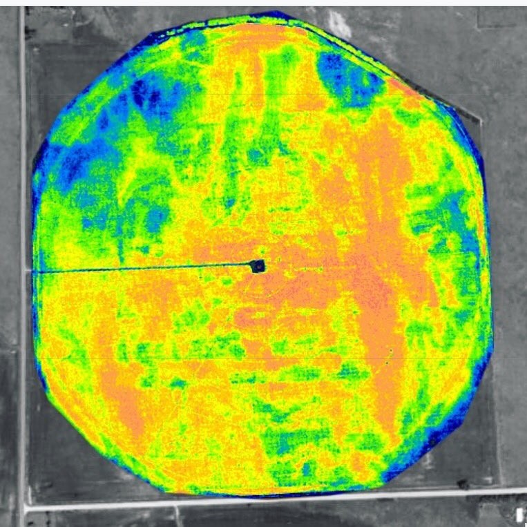
Here is a NDVI imagery of hail damage in a Nebraska corn field.
Edited by wmaiouiru 11/5/2017 18:04
 (DJF0iimUIAIAeHD.jpg_large.jpg) (DJF0iimUIAIAeHD.jpg_large.jpg)
Attachments
----------------
 DJF0iimUIAIAeHD.jpg_large.jpg (161KB - 547 downloads) DJF0iimUIAIAeHD.jpg_large.jpg (161KB - 547 downloads)
|
 Drone owners survey

