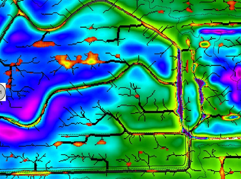
NE South Dakota Clark, SD | A much easier and more accurate way would be to load LIDAR and/or RTK harvest data into GK Tech ADMS. Run the Watershed creation on it. Create a BMP of the lidar, flow paths and depressions, then import into APEX and send out as a background image. Takes about 10 minutes. An even better way would be to trade in SWP for SD Drain and load it into there.
 (Background Image (full).jpg) (Background Image (full).jpg)
 (10_18 Background Images (full).jpg) (10_18 Background Images (full).jpg)
 (3D 2 (full).jpg) (3D 2 (full).jpg)
 (3D (full).jpg) (3D (full).jpg)
Attachments
----------------
 Background Image (full).jpg (176KB - 67 downloads) Background Image (full).jpg (176KB - 67 downloads)
10_18 Background Images (full).jpg (103KB - 63 downloads)
3D 2 (full).jpg (83KB - 63 downloads)
3D (full).jpg (92KB - 71 downloads)
|
 SMS elevation map to 2600

