|
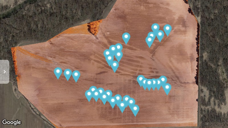
SE Iowa | It’s definitely possible, just need to time your flights after a rain. I’ve done quite a bit of mapping of tile work, DroneDeploy has the best annotation tools to mark up the map and find the coordinates of each tile. So much value now that it’s a processed map instead of individual photos
 (3FD38662-EB86-42E4-8C69-594860478EF7.png) (3FD38662-EB86-42E4-8C69-594860478EF7.png)
 (EDE98054-6B04-42DB-91D1-DAA54D4B0757.png) (EDE98054-6B04-42DB-91D1-DAA54D4B0757.png)
 (146D13A9-4D40-449F-A25E-FE5A580CA958.png) (146D13A9-4D40-449F-A25E-FE5A580CA958.png)
Attachments
----------------
 3FD38662-EB86-42E4-8C69-594860478EF7.png (96KB - 383 downloads) 3FD38662-EB86-42E4-8C69-594860478EF7.png (96KB - 383 downloads)
EDE98054-6B04-42DB-91D1-DAA54D4B0757.png (103KB - 370 downloads)
146D13A9-4D40-449F-A25E-FE5A580CA958.png (77KB - 351 downloads)
| |
|
 Drone for Drainage

