|

Princeton, Indiana | http://websoilsurvey.nrcs.usda.gov/app/WebSoilSurvey.aspx
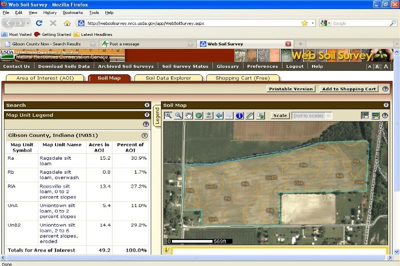
Hit this link. Find your county and zoom in on the field you would like to measure. Use the flexible "AOI" button on the far right side of the menu. Draw a boundary around your field. Hit the "Soil Map" tab and it will give you total acres, acres by soil type, a nice soil map and a description of each soil type. After the map is finished click the "printable version" button and create a PDF file to save or print.
Here is an example of an irregular shaped field that measures 49.2 acres. The field is highlighted with the light blue line. It took about 5 minutes to grab the aerial picture, draw a boundary and post the JPG. The best part is it's free.
Feel free to drop me an e-mail and I would be glad to give a phone number and I'll walk you through an example.
 | |
|
 Measuring acreage on satelite maps


