|
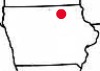
Floyd County, Iowa | farmer82-
Been using that for a few years. Found "lost" tile by looking at the infrared versions. One little thing about it that's kinda useful is the GPS coordinates. The coordinates are down at the bottom of the page. These coordinates are the center of the picture. To find the coordinates of something, Click on "Recenter", move the cursor to whatever you want the coordinates of, click.
| |
|
 Old aerial maps of Iowa

