Cedar Rapids, Iowa | This was part of a speech I gave earlier this week at the Ag Machinery Conference. I thought some of you might find it interesting as well.
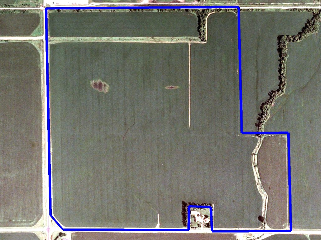
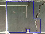
We have one field (155 acres) that is visibly flat. There is one spot in the field that ponds up any time we get a heavy rain. We have been entertaining ideas on how to fix it, but that has created some questions. If we pull tile to it, which direction do we go in order to get the best fall on the tile? If we cut a trench on the surface, what direction do we need to go and how deep? If we fill it with dirt (neighbor has a bunch of black dirt that needs a home), then how much dirt would it take?
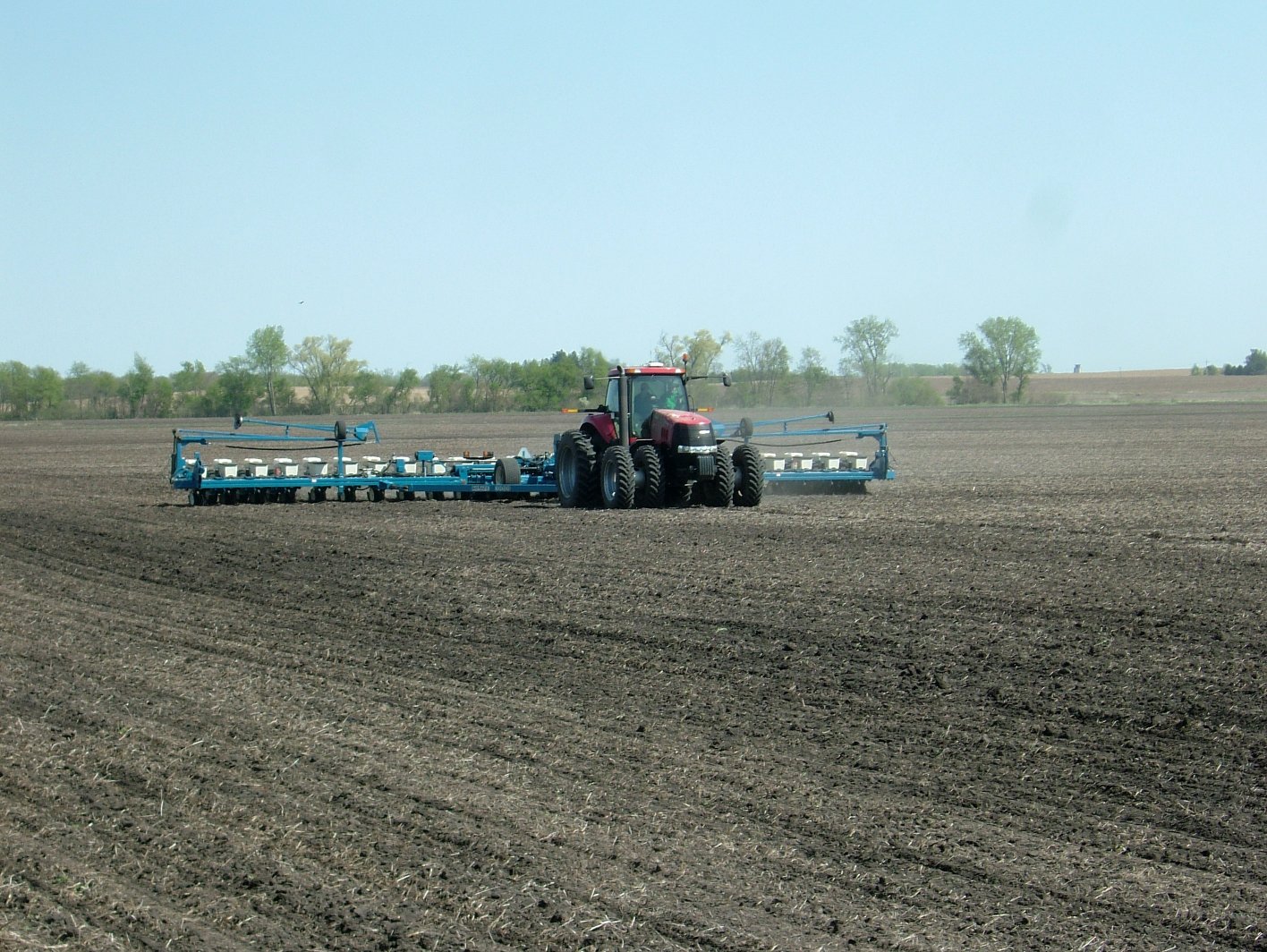
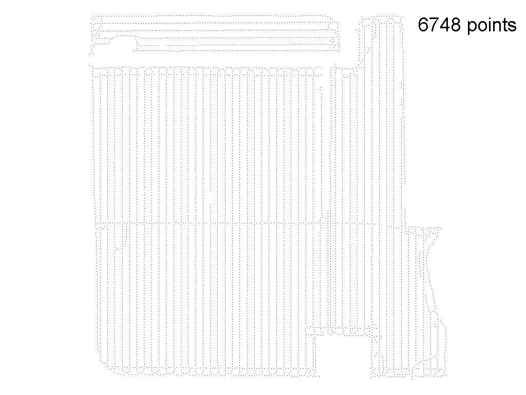
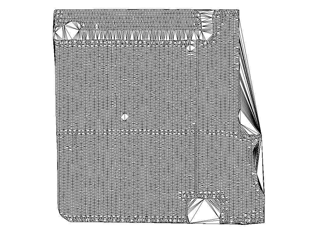
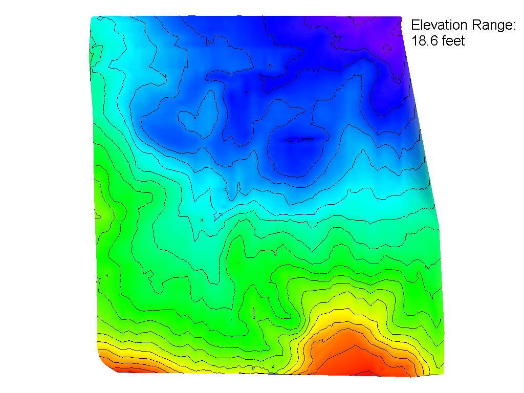
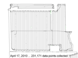
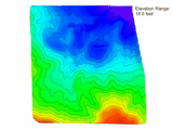
When we planted the field, we were using a 262 receiver on RTK. The correction data was coming from the IA DOT's RTN, and I was using a laptop to get the data off the Internet. That means I have a device capable of logging lots of data. I wrote a few lines of code in my NTRIP Client to have it log the NMEA GGA sentences as they come out of the receiver. Capturing data at 5Hz means that I got 231,171 data points that day. The file is just over 20 MB. I also had some software from a previous elevation project that I adapted to process the NMEA data. Plotted on a screen I can see all the points for the day. I then draw a border around just the data I care about, and export the points inside (with some rules: spaced at least 15 feet apart, RTK points only) into a .NEZ file, which is a common format for surface maps. That leaves 6748 points. I can then open the .NEZ file and render that into a wireframe surface map with colored elevation, contour lines, and some exceptionally nasty code that finds the depressions.
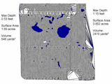
Turns out that this flat field actually has over 18 feet of elevation change. The pond is only 6 inches deep, but it covers 1.7 acres, and would take about 650 cubic yards of dirt to fill.
-Lance
Edited by mx270a 9/25/2011 09:12
|
 Elevation Mapping (Pics)