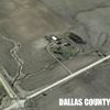
Dallas Center IA 515-720-2463 | Ross,
More pics, May help - May not
These are Google Earth Street Views. Drop the little yellow man where the Google Earth car has not been and you get a pretty decent idea of the lay of the land.
Top - #1
From the parking lot, about #1 on the stuff in above post.
Jail Rock is the Red arrow
Courthouse Rock the Yellow arrow
The worn path from the parking lot to the head of the gully north of the jail -
I have put little Black arrows on. This is looking towards tack #2, at the head of the gully.
Second image
From tack #2 at head of the gully, looking east towards tack #3, northeast of the jail. At the Green arrow.
Again the Jail is the Red arrow. Arrows, I goofed and could not get rid of the mistake arrows.
Image #3-
From tack #3, northeast of the Jail, looking south to the tack 3821’, east of supposed drone location.
Image #4-
From tack 3821’ looking west to the steep slope south of the Jail.
Image #5-
From that rock looking towards the supposed drone location.
Jail at Red arrow, Courthouse Rock at Yellow arrow.
 (ROSS-5 (full).jpg) (ROSS-5 (full).jpg)
 (ROSS-6 (full).jpg) (ROSS-6 (full).jpg)
 (ROSS-7 (full).jpg) (ROSS-7 (full).jpg)
 (ROSS-8 (full).jpg) (ROSS-8 (full).jpg)
 (ROSS-9, (full).jpg) (ROSS-9, (full).jpg)
Attachments
----------------
 ROSS-5 (full).jpg (54KB - 343 downloads) ROSS-5 (full).jpg (54KB - 343 downloads)
ROSS-6 (full).jpg (64KB - 357 downloads)
ROSS-7 (full).jpg (61KB - 370 downloads)
ROSS-8 (full).jpg (62KB - 349 downloads)
ROSS-9, (full).jpg (65KB - 346 downloads)
|
 Find My Mavic Mini and You Can Have It

