
Centre county Pennsylvania, USA |
Static scatter tests (attached) for Trimble RTK and Trimble-WAAS DGPS show that RTK is defiantly needed to achieve elevation topo maps with 0.05 foot accuracy. However those same tests show that for machine attitude (slope) mapping, Trimble's WAAS DGPS provides same accuracy as Trimble RTK. Machine attitude (slope) is computed from 3D position fix 1st differences in both cases. Because machine GPS speed is also computed from position 3D 1st differences, speed accuracy is no better for Trimble RTK than it is for Trimble-WAAS DGPS. Actually, first differences are a form of RTK so test results are no big surprise. Because some lower quality receivers are both "noisy" and limited in 3D position fix resolution, not all WAAS DGPS receivers will provide same accuracy for machine attitude and speed.
 (Trimble RTK scatter.jpg) (Trimble RTK scatter.jpg)
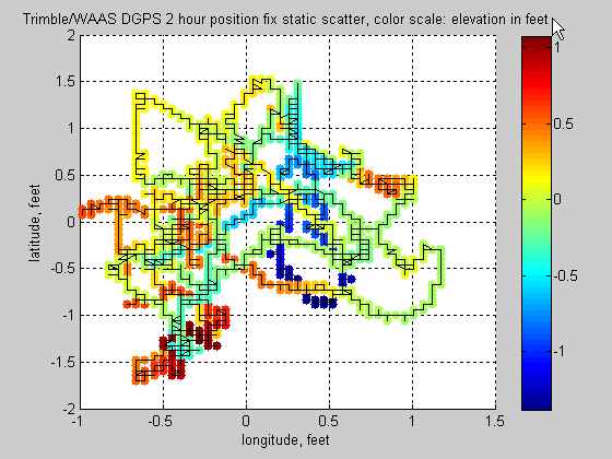 (Trimble-WAAS DGPS scatter.jpg) (Trimble-WAAS DGPS scatter.jpg)
 (Trimble RTK 1st diff scatter.jpg) (Trimble RTK 1st diff scatter.jpg)
 (Trimble-WAAS DGPS 1st diff scatter.jpg) (Trimble-WAAS DGPS 1st diff scatter.jpg)
Attachments
----------------
 Trimble RTK scatter.jpg (25KB - 242 downloads) Trimble RTK scatter.jpg (25KB - 242 downloads)
Trimble-WAAS DGPS scatter.jpg (35KB - 220 downloads)
Trimble RTK 1st diff scatter.jpg (30KB - 236 downloads)
Trimble-WAAS DGPS 1st diff scatter.jpg (38KB - 233 downloads)
|
 GS2 - needing the ability to survey for drainage any compatible software out there.

