Dallas Center IA 515-720-2463 | With what I have that could be done.
Phantom 3 Pro drone
Use a Mac I-Pad on the controller.
Using three Mac putors to look at downloaded images.
2012 MacBook Pro
2014 MacBook Air
2015 MacBook Air
I have in the last few weeks discovered the 2015 MacBook Air will give Latitude and Longitude readings for the aircraft location at the time the picture was taken.
The 2012 model says nothing. I have gotten the 2014 model to give some info However, not very often.
Now it you are looking pretty much out, or looking down at say a 30 degree angle from 300' - Not going to be very close.
But if you have the gimbal pointed straight down, and are fairly close to the surface. You would be pretty close.
Lat & Lon coordinates given are the center of the image.
After downloading into the laptop. Select the image.
Then Click on 'Info'
Box appears. Date and time, etc, etc.
Below 'More Info'
And at the bottom Latitude 41.6629 - Longitude -94.0228
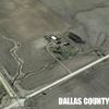
[numbers are for the image I am looking at now. Des Moines Area Community College Dallas County Farm.
Or Double Click on the image - Bring it up as a Preview.
Click on 'Tool' Drop down deal
Click on 'Show Location Info'
Shows the Latitude & Longitude.
Latitude 41* 39' 46.38" N Longitude 94* 1' 22.182" W
Also shows the Altitude. But it is the altitude of the aircraft above sea level.
Not the elevation of the ground surface.
Next I go to Google Earth. Find the lat & lon of the image and put a 'Placemark' on the exact spot.
Picture is the locations of several images I took of my northwest 40 pond.
It is not drowned out this year.
And using the drone I could tell it was OK from a half mile away.
Placemark names are the number from the image.
Note: I have done some work on this spot.
First did a reconnaissance with the elevation deal on Google Earth.
Next went out with a tractor and pull type box scraper.
The tractor had first a Ag Leader Edge display, receiver was WAAS.
Edge showing Elevation.
Move some dirt. keeping my eyes on the elevation deal. Move more.
I do have a three leg level and story pole to check things out real good.
And I can operate the level and pole myself. Just takes time.
Don't have it perfect, but getting there.
With the equipment I have and what I know about running it. I could get the info you want if I was there to get drone pictures right after a big rain.
Pic is a Google Earth of my pond, taken 10 March 2016. Shows last years drowned out real good.
The numbers on the seven tack placemarks are picture numbers.
 (Placemarks.jpg) (Placemarks.jpg)
Attachments
----------------
 Placemarks.jpg (78KB - 372 downloads) Placemarks.jpg (78KB - 372 downloads)
|
 Images fron UAV onto tablet w gps position?

