|
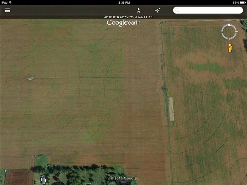
Michigan | This isn't a yield monitor shot, rather an image from google. You can see a distinct line running north and south from the "le" in the word google at the top of the screen down to where the property juts out into the field above 2016. That line is where a fence row was over 25 years ago. Apparently the property to the east of the line was farmed different then west of the line. After 25 years of farming it all as one field and treating it all the same, the portion to the east of the line is still less productive than the west. It has always been this way, the yield monitor would show the same thing as this picture. However there are no real differences in soil tests.
 (image.jpg) (image.jpg)
Attachments
----------------
 image.jpg (99KB - 30 downloads) image.jpg (99KB - 30 downloads)
| |
|
 yield maps showing positive legacy of past management

