|

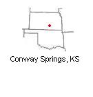
| Our area has a portion that is high resolution. I have seen a swather out cutting alfalfa. Also, the image was taken 3 days after a tornado went through the area. You can see many damaged and destroyed houses, vehicles parked nearby as people are helping pick up. Also, you can see the utility trucks parked on the highway replacing the lines. It was about 2 weeks before wheat harvest, you can easily see the path of the tornadoes (multiple paths) through the area. | |
|


 Machinery Pics--On Google Earth?