|
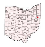
northeastern Ohio | This was posted on Facebook, so I am skeptical of it's validity. But it is interesting to see if the prediction comes true:
NORTHERN OHIO IF THIS EL NIÑO REALLY PUSHES 3 TO 4°C, WE’RE ENTERING “UNCHARTED TERRITORY”
The strongest El Niño ever recorded was 2.6°C (2015–16).
If projections verify a 3 to 4°C event, we’d be exceeding the most powerful El Niño in modern history.
That means the atmosphere may respond in bigger, stranger, and more surprising ways than typical strong El Niño years.
WHAT A 3 TO 4°C EL NIÑO ACTUALLY MEANS
When the Niño 3.4 region warms this much, the Pacific becomes a climate supercharger.
This level of warming can:
Shift the jet stream thousands of miles
Supercharge moisture transport
Alter storm tracks across the entire U.S.
Lock in season long patterns
And remember:
The strongest El Niño ever measured was 2.6°C.
If we push into the 3 to 4°C range, we’re in a zone where the atmosphere may behave in ways we haven’t fully observed before.
LATE SUMMER (AUG–SEP) “THE HUMIDITY HANGOVER”
A super charged El Niño tends to:
Pump tropical moisture into the U.S.
Increase heavy rain events
Boost humidity
Create warm, muggy nights
Northern Ohio often sees:
Above normal rainfall
Storm clusters riding the jet
A few high impact severe weather setups
Think:
Warm. Muggy. Stormy. Almost tropical at times.
FALL (SEP–NOV) “THE TRANSITION TUG OF WAR”
As El Niño strengthens:
The subtropical jet becomes more active
Storm systems become more frequent
Temperature swings get sharper
Northern Ohio fall patterns often include:
Mild stretches that feel like bonus summer
Sharp cool downs behind strong fronts
Above normal rainfall
A delayed first frost
This is the season where people say:
“Why does it feel like we skipped normal fall?”
WINTER (DEC–FEB) “THE CLASSIC EL NIÑO SIGNATURE”
A 3 to 4°C El Niño would strongly favor:
WARMER THAN NORMAL WINTERS
Fewer arctic blasts
More 40s and 50s
Long stretches of mild weather
MORE RAIN THAN SNOW
Storm track shifts south
Warm air intrusions dominate
Snow events turn into slop storms or cold rain
BELOW NORMAL SNOWFALL
Even the snowbelt struggles because:
Lake effect needs cold
El Niño winters usually lack it
BIG LAKE EFFECT EVENTS ARE RARE
Not impossible, but rare.
BOTTOM LINE FOR NORTHERN OHIO
If El Niño really spikes to 3 to 4°C, expect:
Late Summer Warm, humid, stormy
Fall Mild, wet, volatile
Winter Warm, more rain than snow, potentially below normal precipitation and frustrating for snow lovers
And because this would exceed the strongest El Niño ever recorded, there’s real potential for surprising, unusual, or amplified weather patterns.
Warm weather fans?
Your era is coming.
Snow lovers?
You might want to emotionally prepare now.
 (693556478_980139214623061_2679076152652023595_n (full).jpg) (693556478_980139214623061_2679076152652023595_n (full).jpg)
Attachments
----------------
 693556478_980139214623061_2679076152652023595_n (full).jpg (73KB - 29 downloads) 693556478_980139214623061_2679076152652023595_n (full).jpg (73KB - 29 downloads)
| |
|

 El Nino forecast


