
WC MN & Valley of the Sun, AZ | https://www.wpc.ncep.noaa.gov/exper/gefs/gefs.html#
Edited by Schuerman Farms 5/17/2019 14:52
 (2019-05-16 12-28-23_GEFS Ensemble Probability Display (full).png) (2019-05-16 12-28-23_GEFS Ensemble Probability Display (full).png)
 (2019-05-16 12-28-06_GEFS Ensemble Probability Display (full).png) (2019-05-16 12-28-06_GEFS Ensemble Probability Display (full).png)
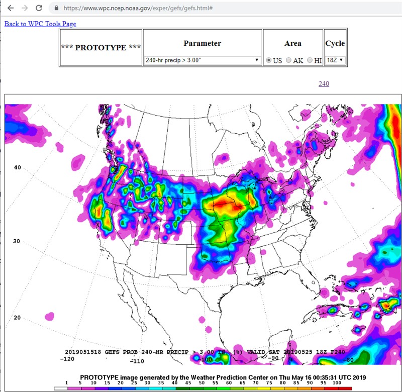 (2019-05-16 12-29-05_GEFS Ensemble Probability Display (full).png) (2019-05-16 12-29-05_GEFS Ensemble Probability Display (full).png)
 (2019-05-16 12-29-22_GEFS Ensemble Probability Display (full).png) (2019-05-16 12-29-22_GEFS Ensemble Probability Display (full).png)
 (2019-05-16 12-29-39_GEFS Ensemble Probability Display (full).png) (2019-05-16 12-29-39_GEFS Ensemble Probability Display (full).png)
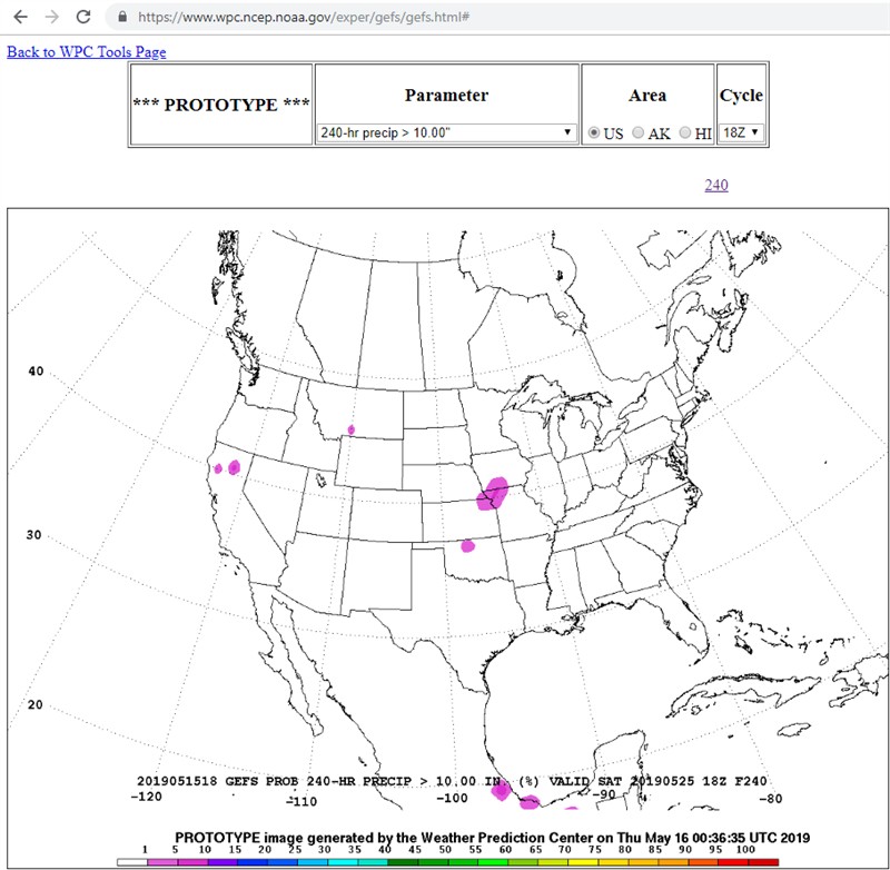 (2019-05-16 12-29-54_GEFS Ensemble Probability Display (full).png) (2019-05-16 12-29-54_GEFS Ensemble Probability Display (full).png)
Attachments
----------------
 2019-05-16 12-28-23_GEFS Ensemble Probability Display (full).png (213KB - 19 downloads) 2019-05-16 12-28-23_GEFS Ensemble Probability Display (full).png (213KB - 19 downloads)
2019-05-16 12-28-06_GEFS Ensemble Probability Display (full).png (196KB - 12 downloads)
2019-05-16 12-29-05_GEFS Ensemble Probability Display (full).png (177KB - 14 downloads)
2019-05-16 12-29-22_GEFS Ensemble Probability Display (full).png (158KB - 20 downloads)
2019-05-16 12-29-39_GEFS Ensemble Probability Display (full).png (147KB - 16 downloads)
2019-05-16 12-29-54_GEFS Ensemble Probability Display (full).png (126KB - 11 downloads)
|
 10-Day Precipitation National Maps (updated Friday)

