|

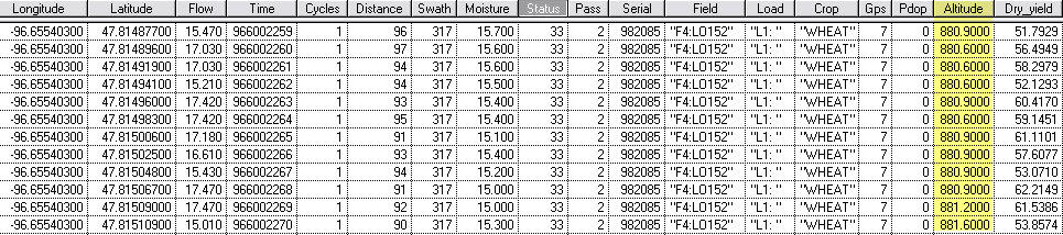
| The only way it can be done accurate with yield monitor data is using a RTK system on your combine. Besides yield, moisture, swath width, long and lat, the elevation is collected. The image below is from an AgLeader export. The column highlighted in yellow would be the elevation. For most software program instead of showing yield select the altitude column for your map.
But if you are using WAAS, or any decimeter system the altitude error is 3x greater than the lat and long. If you need only a +/- 6” it would be interesting to see if SF2 or Omni Star would be good enough for your purposes.
gary
 (agleader data.jpg) (agleader data.jpg)
Attachments
----------------
 agleader data.jpg (106KB - 147 downloads) agleader data.jpg (106KB - 147 downloads)
| |
|
 Elevation Mapping

