West Central Alberta Coldest, wettest edge | For anyone who missed it, this website shows cropland distribution across the globe: https://web.croplands.org/app/map?lat=51.6717&lng=-115.73890686035158&zoom=11
And the accompanying article:
https://www.bloomberg.com/amp/news/articles/2017-11-14/there-s-more-farmland-in-the-world-than-was-previously-thought
I think I know where the extra acres came from. Here is one example:
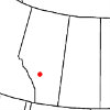
This is straight west of my farm. most of this image is in Banff or Jasper national park, at very high elevation in the mountains. Some of the areas to the east are cut blocks. There is no cropland withing 50 miles of this image.
Closer to home, it includes many lakes in the middle of forests, oil and gas facilities. and many other random areas as cropland. It is impressive that software is able to pick cropland out of an image, but it needs some more tweaking, at least in this environment.
Edited by Alberta Farmer 11/19/2017 00:11
 (mountains.PNG) (mountains.PNG)
Attachments
----------------
 mountains.PNG (156KB - 74 downloads) mountains.PNG (156KB - 74 downloads)
|
 They ain't makin more of it post from below ( global cropland map)

