|

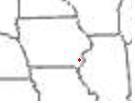
Kingston, Iowa | We have a farm that we custom work. By GPS border measurements by our customers insurance company it is 78.44 acres. SMS tells me when we plant and harvest it, it is 82.84 spatially defined by SMS and 85.56 using the monitor summary. The field has about every thing going for it, if your looking for measurement descrepancies. It has a fairly deep v'ed waterway in the middle running perpendicular to the rows and one end has several tall terraces that we farm over parrellel.
The past several years, since I had a GPS reciever capable of putting out speed signal. I've used it as the speed source because it was easier and the console was already set up for that from planting. This year I went back to the speed sensor on the transmission. Not saying it was any part of it, but I was happier with the overall accuracy of the monitor this year vs past.
| |
|


 Productivity Map on Ripper = Soil Density Map?